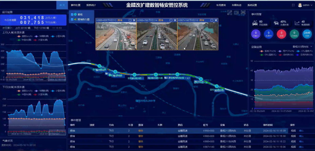
G60 Shanghai-Kuming Highway Smart Safety Enhancement System
The design of data cascading and overall coverage is adopted to deploy sensing devices in the reconstruction and expansion areas. The system is able to collect traffic data including license plate, vehicle model, vehicle trajectory and traffic events, illegal stop, reversed driving direction, over-speeding, illegal intrusion in construction areas, etc.
The system software platform manages multi-mode traffic data and meteorological data digitally. Real scene restoration of the entire road section is realized to make the traffic data and the entire vehicle track visible.
The events can be traced and safety can be predicted, which improves the efficiency of road traffic control in the expansion project. The system assisted decision-makers to carry out emergency plans and provide timely support service for any potential events…
Products & services provided : GIS maps / license plate recognition and tracking / safety management system platform /radar anpr cameras /lane trajectory tracking algorithm /radar video fusion technology / overall deployment application
Application achievement :
- Real-time and proactive reporting of events helps to save more than 80% of manual operation, improves real-time handling capabilities by more than 60%, and increases the accuracy of proactive traffic diversion by 99%, no longer relying on manual operation.
- The real-time location after the event occurs is linked with the event camera to ensure the accuracy and efficiency of event processing.
- Event tracking can help with the post-event analysis and determination and provide strong decision-making support for traffic management departments.

 ZTRadar Technology